

Ride Summary
- Difficulty: Easy
- Total Distance: 13 miles
- Parking: Free, Paved Lot
- Suggested Ride Season: Any
- Bikeway Type: Mixed use trail
- Bikeway Surface: Paved trail, surface streets
- Trail Quality: Excellent
- Suggested Bike Type: Any
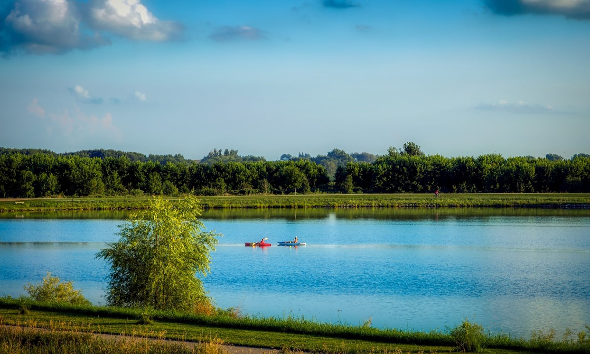
A quick visual inspection of the Mississippi River throughout the Midwest reveals a plethora of small islands around which state lines serpentine. Of these, Credit Island bears with it a long and varied history. Now a 420-acre community park owned and managed by the City of Davenport, Iowa, Credit Island has received renewed interest since the 2010’s through renovations and improvements, and celebrated its bicentennial in 2014. This route is great for a quick, easy bike ride (or run) with great river views, or as the turnaround point for a longer ride on the Riverfront Trail and takes you to the far west end of Davenport on the trail system.
The Route

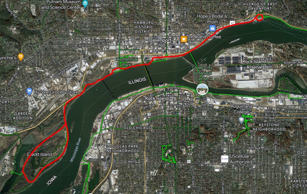
This short, approximately 13-mile, ride starts off at Lower Lindsay Park—just off the east end of the Lindsay Park Yacht Club parking lot (located at the south terminus of Mound Street across from the East Village in Davenport, Iowa). While you can certainly add extra miles to this route with ease, you’ll want to at least stop though the park, as the sculptures found here at Lower Lindsay used to be a fixture on Credit Island.
Sunday in the Park, a collection of fiberglass statues depicting George Seurat’s A Sunday Afternoon on the Island of La Grande Jatte, was first installed on Credit Island in 2000, but was moved and renovated (Jean Downey) in late July 2022 due to recurrent flooding and vandalism. Take a moment to interact with these near-life-size statues designed by local artist, McElhiney, and carved by Thom Gleich before setting off.
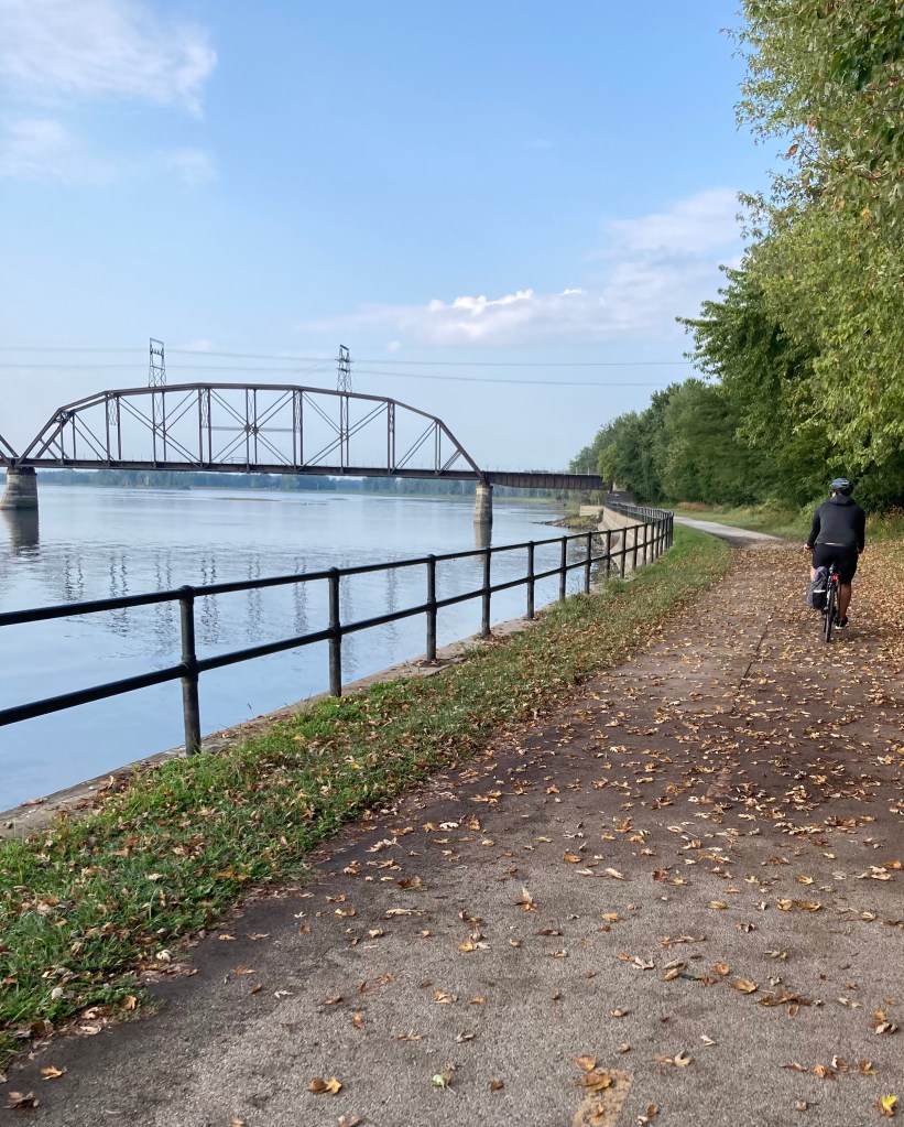
From Lower Lindsay Park, you’ll access the Riverfront Trail heading west. For the first 3 miles, until the Crescent Rail Bridge (Rock Island Preservation Society shares some interesting history on this bridge if you’re interested), you’ll have riverfront views, spectacular for upcoming fall foliage, but great at any time of year.
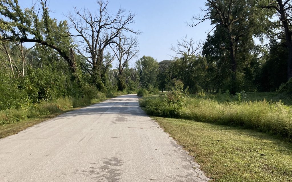
From the rail bridge, the trail becomes more secluded, and apart from tree cover, riders can expect to enjoy the aromas of the nearby Purina plant.
It’s an experience.
The trail terminates at Credit Island Road by which visitors can access the island. The road offers separated, unprotected run/bike lanes to get you onto the island, but from there, you’ll hop onto the quiet surface street that runs around the perimeter, so keep an eye out for motorists as you travel within the park.
Logistics
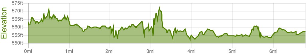
Since this route sticks close to the river, you can expect a flat, smooth ride with a total of 144 feet of ascent and 150 feet of descent. As stated, the majority of this ride takes place on the Riverfront Trail and the remainder on surface streets at the island, so ride surfaces are overall excellent. Due to almost annual flooding at the island, the surface street there sees quite a bit of wear, and debris tends to collect in the walk/bike lane but is easily navigable given the low amount of traffic.
Lessons Learned: Personal Safety Notes
Once you pass the rail bridge the route becomes noticeably more secluded. As seen with the statues, there have been issues in the park with vandalism. In the past, seclusion also played into Credit Island’s reputation for unsavory behavior from late-night visitors which the City of Davenport and it’s police department have taken actions to address.
The City has put a lot of time and effort into the revitalization of the park. Personally, I feel more comfortable visiting with company, and while park hours are listed online as 6am-9pm, lighting on the island is limited to certain areas leaving most of the roadways in darkness after sunset.
That being said, the park wasn’t completely deserted. During our visit, we saw plenty of people fishing, multiple families enjoying the weather, and groups of runners as well as folks out walking their dogs.
Bottom line, be alert and stay safe, just as you would anywhere else.

Nature/Attractions
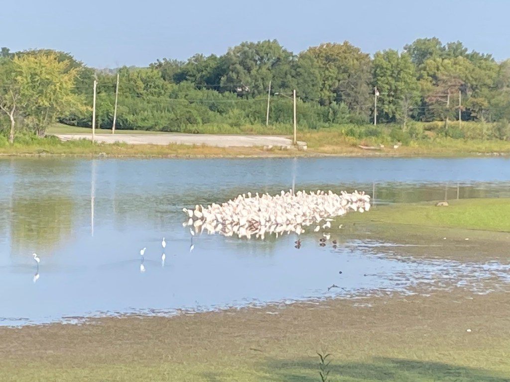
Credit Island is home to an abundant variety of waterfowl and other bird species, making it an ideal location for birding enthusiasts. Depending on the season, visitors can expect to see large numbers of Great Egrets fishing in the river shallows, or Canadian Geese and various duck species enjoying the pond at the center of the island. A boat ramp and rock banks also make this a quiet spot for fishing or just a place to watch the boats go by on the river.
According to the City of Davenport’s website, Credit Island Park also offers a wide range of recreational amenities including an 18-hole disc golf course, two baseball diamonds, basketball and tennis courts, horseshoe pits, playgrounds, nature trails, reservable shelters (aforementioned, no electricity), and historic areas. There are also restrooms available on the island.
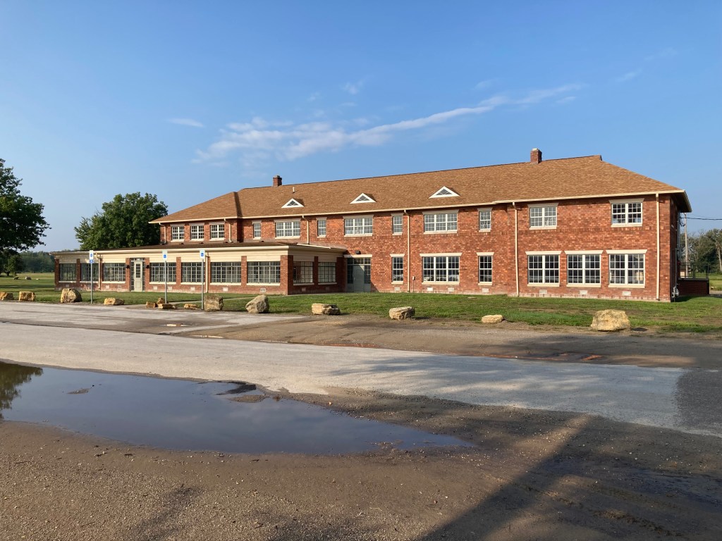
Of particular note, and probably the crown jewel of Credit Island, is the historic Credit Island Lodge. This 2-story brick lodge offers a fantastic view of the river and can be rented for anywhere between 4 hours and the whole day. Lodge capacity is listed as 200, but seats approximately 115. If you’re looking to reserve the lodge or just want to get a peek inside, City Staff are onsite for weekly open houses every Thursday from 3:30-5:30pm (some variations in time and closure dates possible). You can read more about lodge amenities, reservations, and pricing here. Can’t make it to the island? The City of Davenport has graciously put together a virtual tour as well.
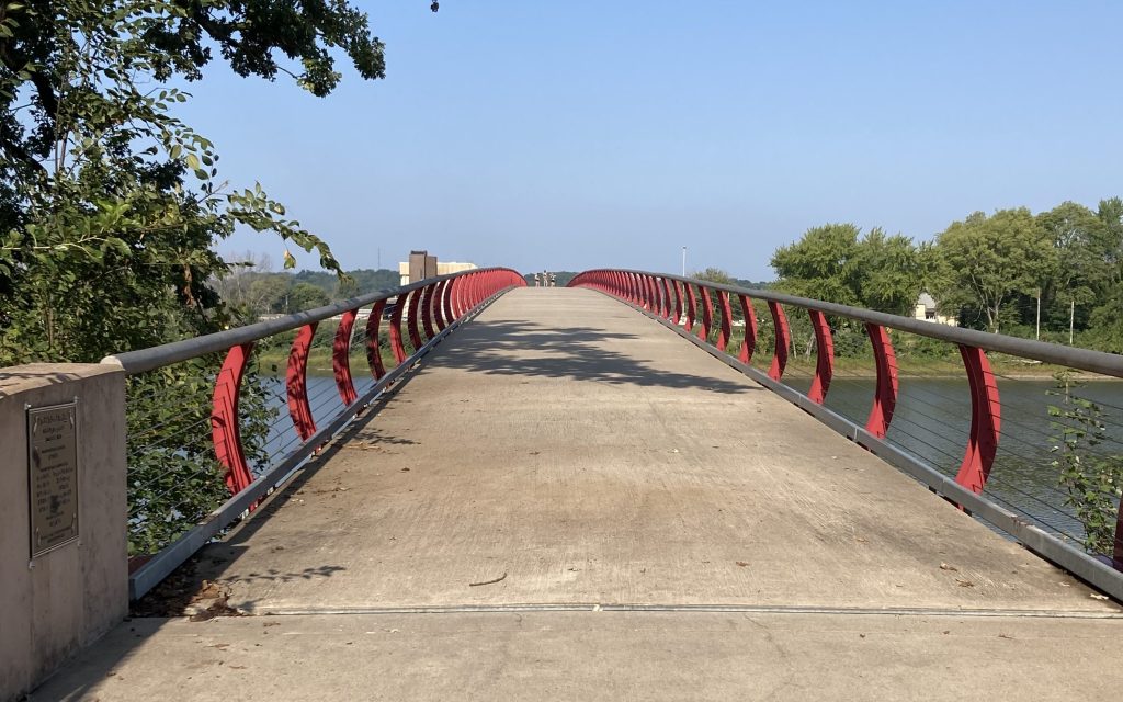
No trip to Credit Island is complete without a visit to the pedestrian bridge located on the back end of the island. Here, visitors can enjoy fantastic views of the river where it flows in behind the island, and the bridge connects back to the mainland at South Concord Street.
Credit Island has also seen more frequent use as an event location in Davenport including the recently-held Renaissance Faire (as of September 2023), so keep your eyes peeled for upcoming events.
Historical Highlights
Credit Island, listed in the Davenport Register of Historic Properties since 1999, served as one of the earliest Native American trading posts west of the Mississippi River as well as a battleground during the War of 1812.
Ownership and Island Amenities
Between 1868 and 1918, several private owners purchased the island. Credit Island changed names several times to include Offerman’s Island, Suburban Island, Grand Island, Manhattan Island and the Grand Isle.
The early 1900s brought interesting developments to Credit Island. An electric trolly delivered locals to Credit Island where they could enjoy their leisure time picnicking and swimming. By 1905, the island also hosted a small amusement park, as did other islands in the area, including a figure-8 roller coaster until around 1917. During the early 1910’s, the island was used as an airfield and housed the Davenport Aviation School for pilot training. One of the school’s students, Neta Snook, went on to create her own aviation school where she instructed Amelia Earhart.

In 1918, the City of Davenport purchased the island and held a contest, resulting in the current naming of Credit Island, derived from its use as an early trading post where Native Americans could barter with Europeans to receive credit for purchases such as traps, beads, kettles, and other goods on the promise of forthcoming hides and skins at the end of the season.
Another feature of the island made available from 1922-2009 by the City of Davenport included a 9-hole golf course which, after it’s closure in 2009, was converted into the current disc golf course.
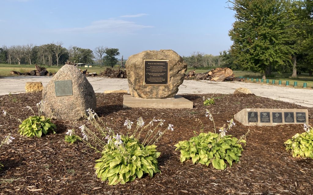
War of 1812: Battle of Credit Island
On site at Credit Island, visitors can find several installations of monuments to the Battle of Credit Island, the last battle for control of the upper Mississippi River during the war. The short story is this:
Between late August and early September 1814, American troops under the command of Major Zachary Taylor engaged with British troops encamped at Credit Island and Native American warriors (allied with the British) in several skirmishes on the Mississippi River between Rock Island and Credit Island as part of an attempt to and gain control of the fort at Prairie du Chien.
With the assistance of local tribal leaders and their warriors [Sioux, Sauk, and Meskwaki (Sac and Fox)] as well as a cannon transported downriver from the fort, the British were able to hold their position and force Taylor and his troops (approximately 350 men) to retreat south on the river.
