
Ride Summary
Difficulty: Easy
Total Distance: 28 miles
Parking: Free, Paved Lot
Ride Season: Spring-Autumn
Bikeway Type: Mixed use trail; three unprotected roadway crossings
Bikeway Surface: Multi-surface (asphalt, packed dirt, gravel)
Trail Quality: Fair
Suggested Bike Type: Any
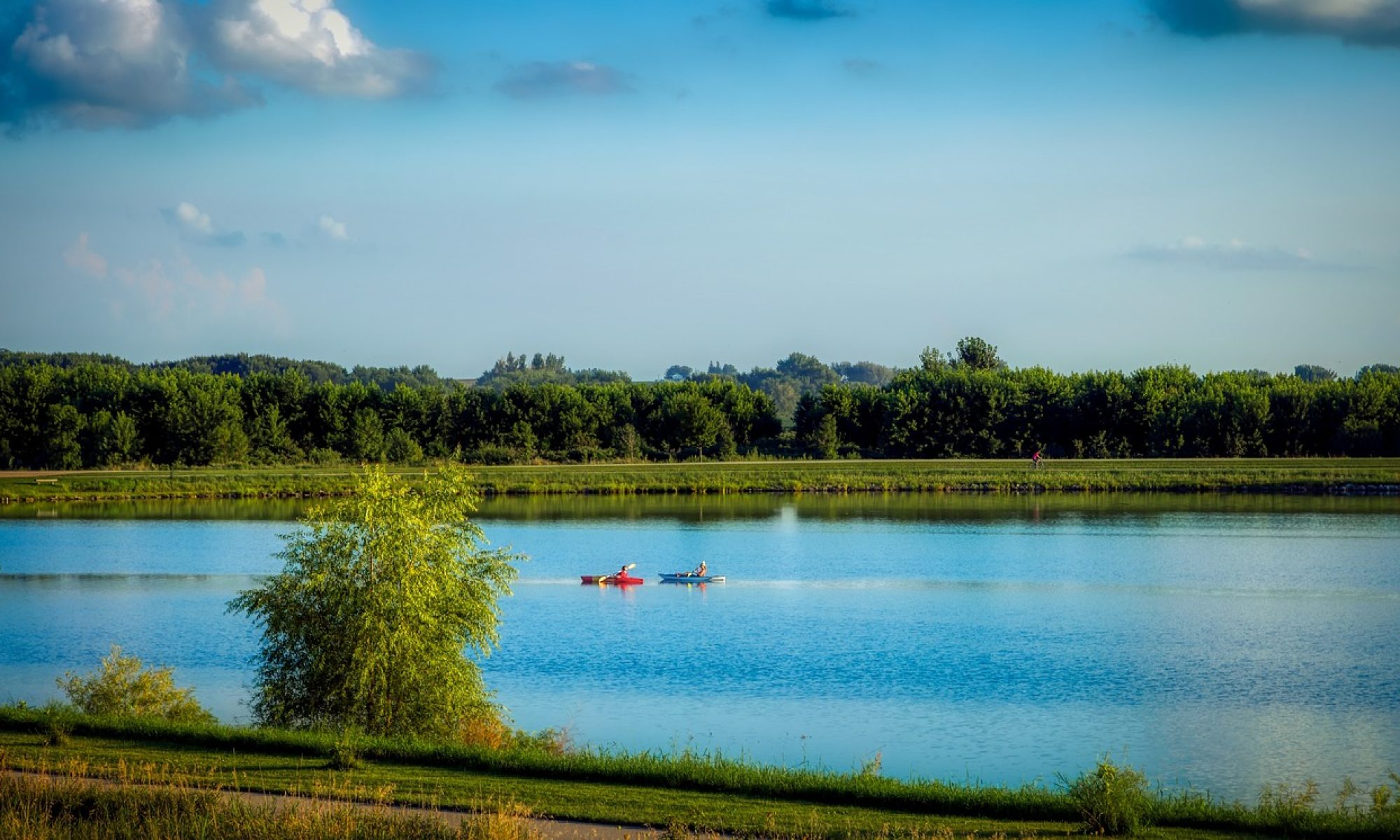
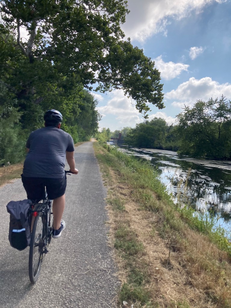
There’s something meditative about time spent alongside a body of water—large or small—and if you’re looking for a peaceful adventure to usher in the fall season, look no farther than the Hennepin Canal State Trail. If you’re in it for six miles or 60, the trail has you covered. While there’s a 5-mile section of trail that takes riders through Milan, the bulk of the Hennepin Canal trail runs a total of about 60 miles between Colona and Bureau Junction, IL. Prepare to do a little contemplative reflecting as you can expect quiet, solitary, nature-filled miles taking this ride across rural Illinois.
The Route
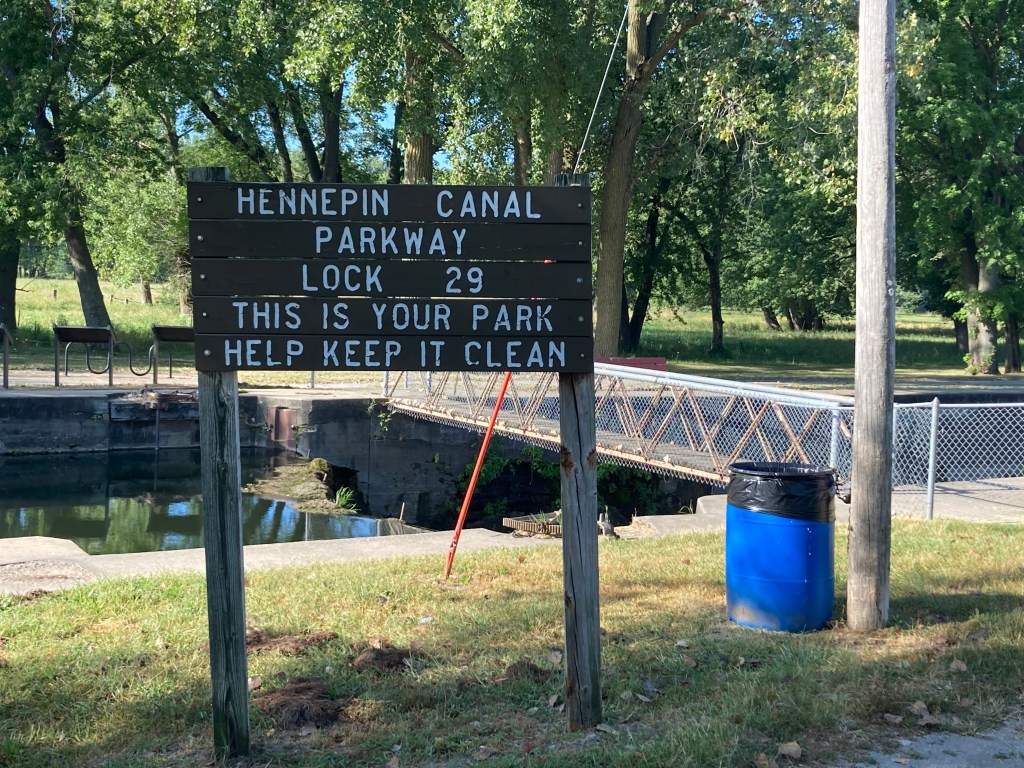
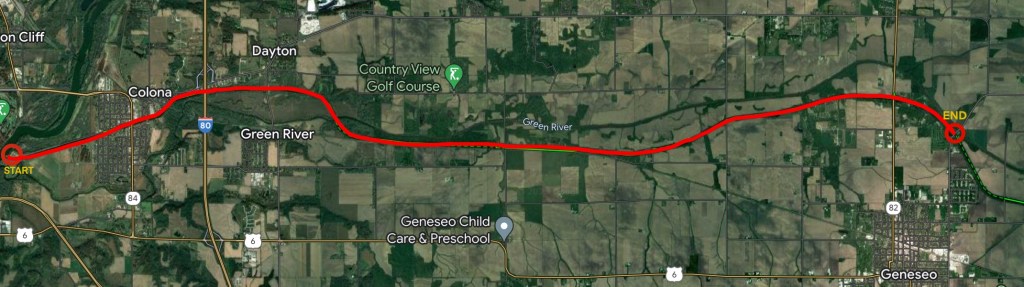
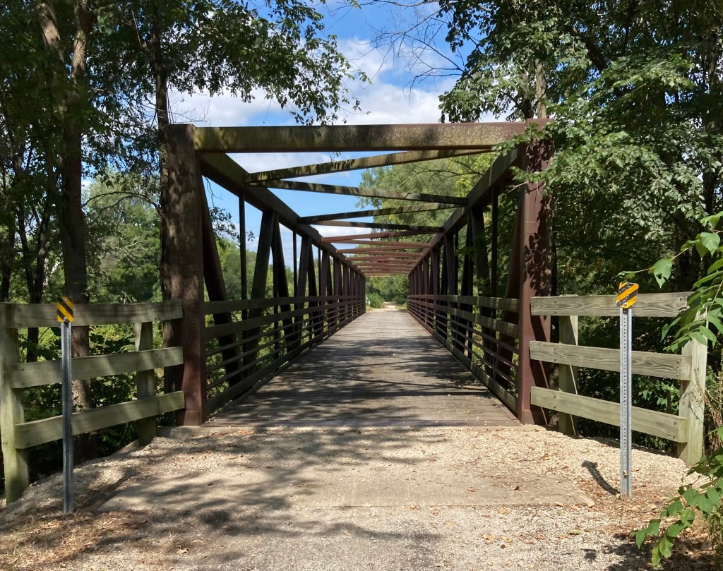
The Colona-Geneseo portion of the trail makes for a leisurely, but deceptive ride clocking in at around 28 miles, round trip, but don’t let the distance deter you as it’s easy to turn around whenever your legs tell you it’s time. Plan to give yourself a few hours for an undemanding pace that includes plenty of stops for photos and scenic views. This portion of the trail starts at Lock 29 trailhead located just west of Colona where the canal empties into the Rock River and makes the turnaround (14 miles out) where the trail intersects Grange Road just north of Geneseo. Parking at Lock 29 serves both the Hennepin Canal Trail and Timbrook Field boat ramp and is located across the canal from the trail. Riders can access the trail via the pedestrian bridge onsite.
Logistics
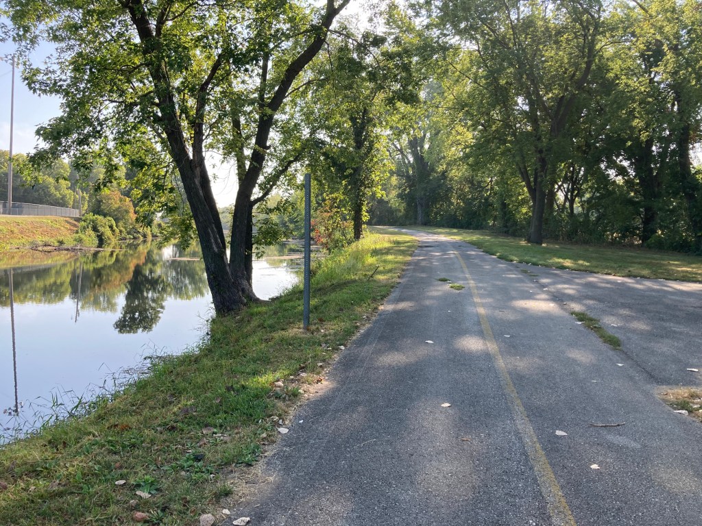
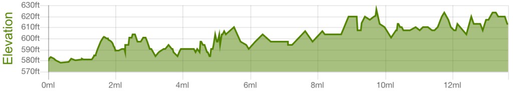
Apart from a few minor climbs, the trail is a straight, flat shot with 275 feet of ascent and 241 feet of descent by the turnaround at Grange Road. Expect a smooth ride starting out, but overall trail surfaces rate fair as the paving quality declines after exiting Colona city limits. Enjoy the canal views, but make sure to keep one eye on the road and anticipate a few backfilled washout areas as well as intermittent potholes and other imperfections.
Crossings
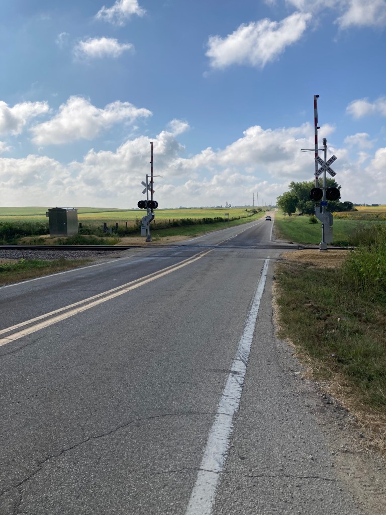
Almost all roads crossing the path utilize pedestrian underpasses, however the following instances involve unprotected crossings or shared roadway:
- ~Mile 1.5: 6th street in Colona; on a bit of an S curve, but crosses at a pedestrian crosswalk
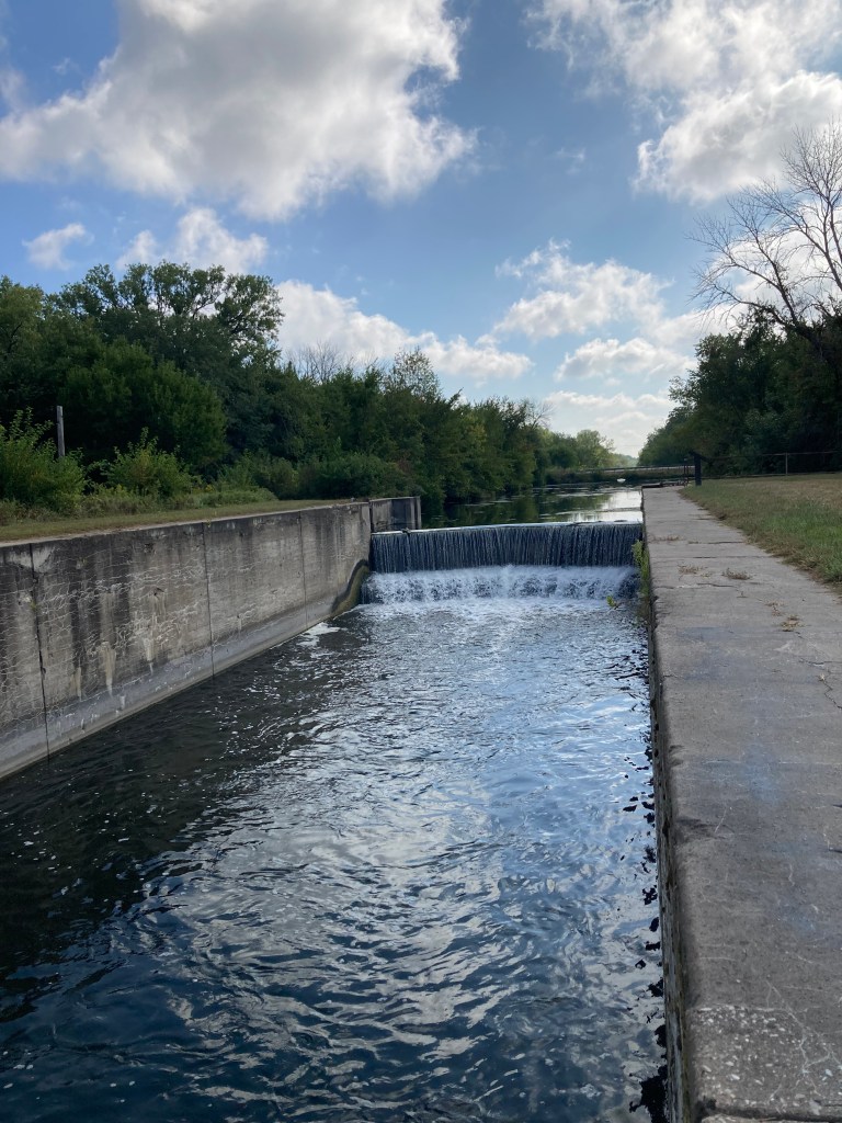
- ~Mile 9, after crossing the canal at Lock 26, make a short jog (~200 ft) North on the surface street to meet back up with the trail again; crossing occurs near a corner
- ~Mile 10: E 1200th, however miles of visibility in either direction
Lessons Learned: Stay on the Trail
Not pictured: the sandpit of death.
Right before crossing the bridge at the Green River (~mile 4.7), the trail makes a quick swerve. It’s tempting to keep straight and take the worn, off-road path through the weeds and grass, but save yourself the fall or at least a shoe full of sand and don’t take the shortcut. It starts off okay, but the sandpit halfway through will capture you in its clutches, and you’ll likely walk the rest of the way out. Unless you’ve got the right tires for it, I don’t recommend it.
Nature/Attractions
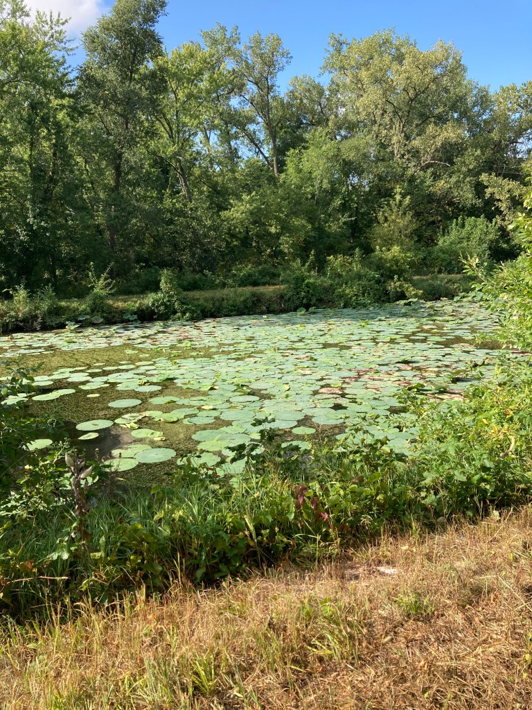
The canal is a popular fishing location, and pole and tackle are easily transportable by bike. Most of the traffic observed on the canal are those enjoying a few recreational casts for a variety of species, and the Illinois Department of Natural Resources reports stocking Largemouth Bass and Sauger annually. [For more detailed information on canal fishing, check out this IDNR report.] Over the years, the five-foot-deep canal has built up a heavy sediment layer in addition to moss and areas of heavy overgrowth from plants like lily pads; however fishing off bridges and in close proximity to the locks appears to be popular as the moving water makes for the best place to avoid lure-snagging obstacles. If you’re willing to leave the trail more than a few feet and wade through the long grass (read: tick warning) you’re very likely to find some good spots, but there are plenty of opportunities for those who aren’t into the creepy-crawlies.
If you’re into bird watching, consider bringing along binoculars as this route is rife with any number of feathered friends including Herons, ducks, and pheasants as well as smaller species. Other wildlife (namely squirrels and other small rodents) can be seen skittering along in the thick tree line that runs along the majority of the trail. This route also boasts a healthy number of turtles who can be seen sunning on the logs and wood debris in the canal.
From spring to autumn, there’s no bad time to check out the Hennepin Canal Trail. In spring, several open meadows on either side of the canal offer flower viewing, and the impressive collection of lily pads that fill the canal bloom from early spring until their dormancy in late summer/early fall. The plentiful overhang of trees along the trail offers much-needed respite from the sun on hot summer days and an ideal opportunity for leaf peeping in the fall.
If you’re looking to add more recreation to your trip, you can also find several picnic areas along this route. Several tables and benches can be found within the first 1.5 miles from Lock 29 but the following locations also offer amenities:
- Veteran’s Memorial Pavillion | ~Mile 1.7 — picnic tables and a covered pavillion as well as horseshoe courts, trash cans, and charcoal grills
- Lock 26 | ~Mile 9 — restrooms, picnic bench, grill, and open grassy area
- Isaac Walton League (Geneseo Chapter) | ~Mile 13 — requires roadway sharing to cross bridge on IL Route 82; picnic tables, camping, and fishing
The Canal: Historical Highlights
Initially, the Chicago District built the Hennepin Canal to facilitate cargo deliveries between Chicago and Rock Island; however poor timing played heavily into the canal’s lack of commercial success. In short, despite early planning for the canal (which beginning in 1834), state financial issues and preliminary survey approval by Congress held the project back until 1871. It then took another 21 years (1892) to begin construction, and after over a decade of work requiring thousands of men using horse-drawn earth scrapers as well as newly developed machines, the canal finally opened for its maiden voyage in 1907, at which point rail transport was already the primary choice for cargo deliveries. Although the canal lessened delivery distance from Chicago to Rock Island by 419 miles and offered cheaper delivery costs than rail, the canal couldn’t compete with the quantities of shipping loads afforded by train. While the widening of the locks on the Illinois and Mississippi Rivers along the route in the 20s permitted the use of larger cargo barges (thus increasing shipping capacity), the barges were subsequently too large to navigate the canal and, ultimately, rail won out and the canal closed to commercial traffic in 1951.
Despite its lack of commercial success, the Hennepin Canal was the first concrete canal in America (as opposed to prior canals which were made from cut stone) and is believed to be the model for the Panama Canal. The entirety of the canal—all 33 locks— is listed in the National Register of Historic Places. Of the 33 locks, only 32 remain visible as Lock #1 has been underwater since the 1930s.
For more history, fun facts, hike schedules, and events, check out Friends of the Hennepin Canal.
